

3D Scanning - Photogrammetry
Through our partner Ocean Discovery, BUVI Scandinavia can carry out 3D Scanning/Photogrammetry.
Building relationships and partnerships with our customers is important to us.
When you ask, we make suggestions for solutions.
When you have a specific need or requirement, we provide solutions.
3D Scanning - Photogrammetry Applications Examples
The method is used in a number of different applications such as:
Port inspections
Bridge foundations
Pipelines
Tunnels
Underwater infrastructure
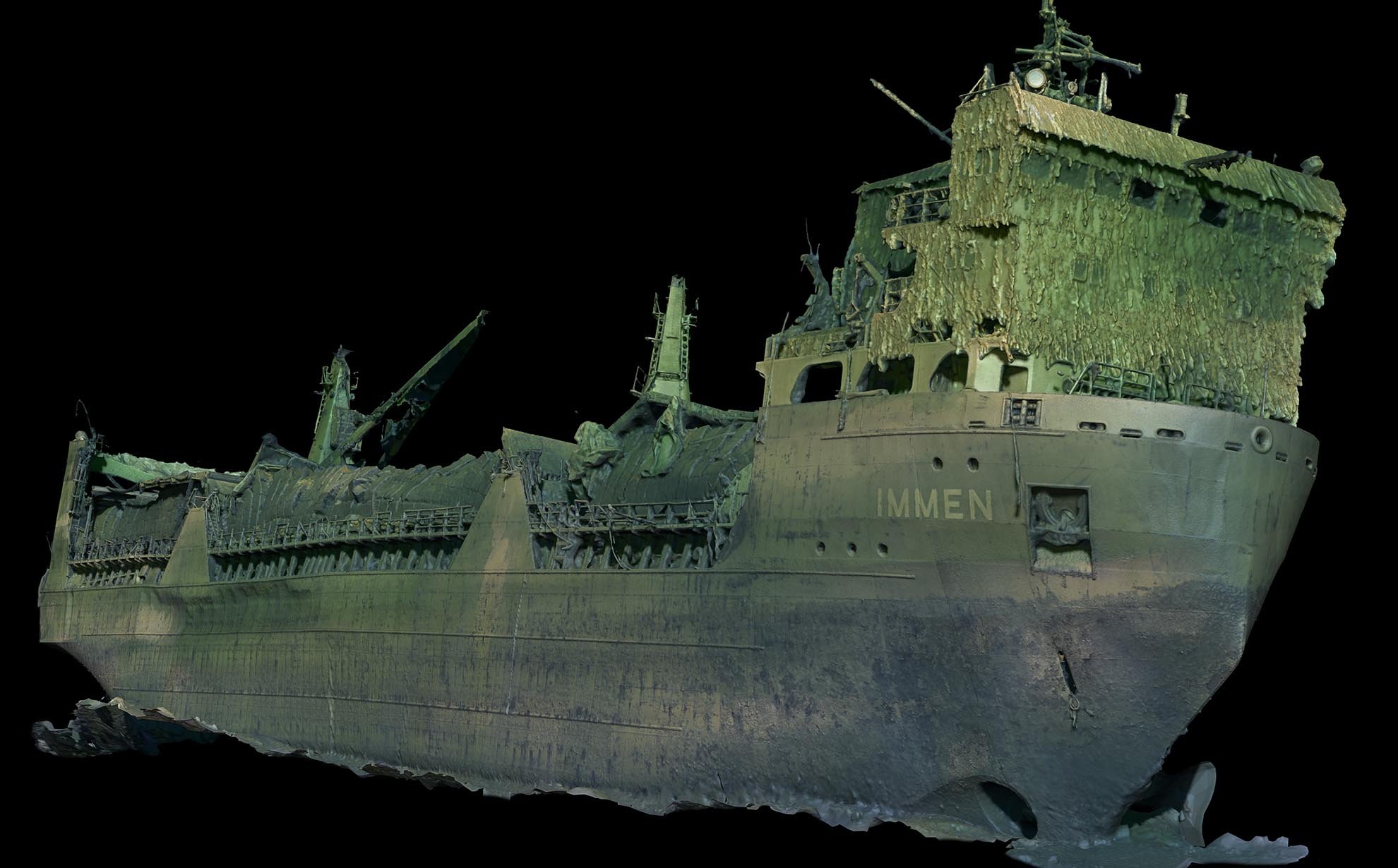
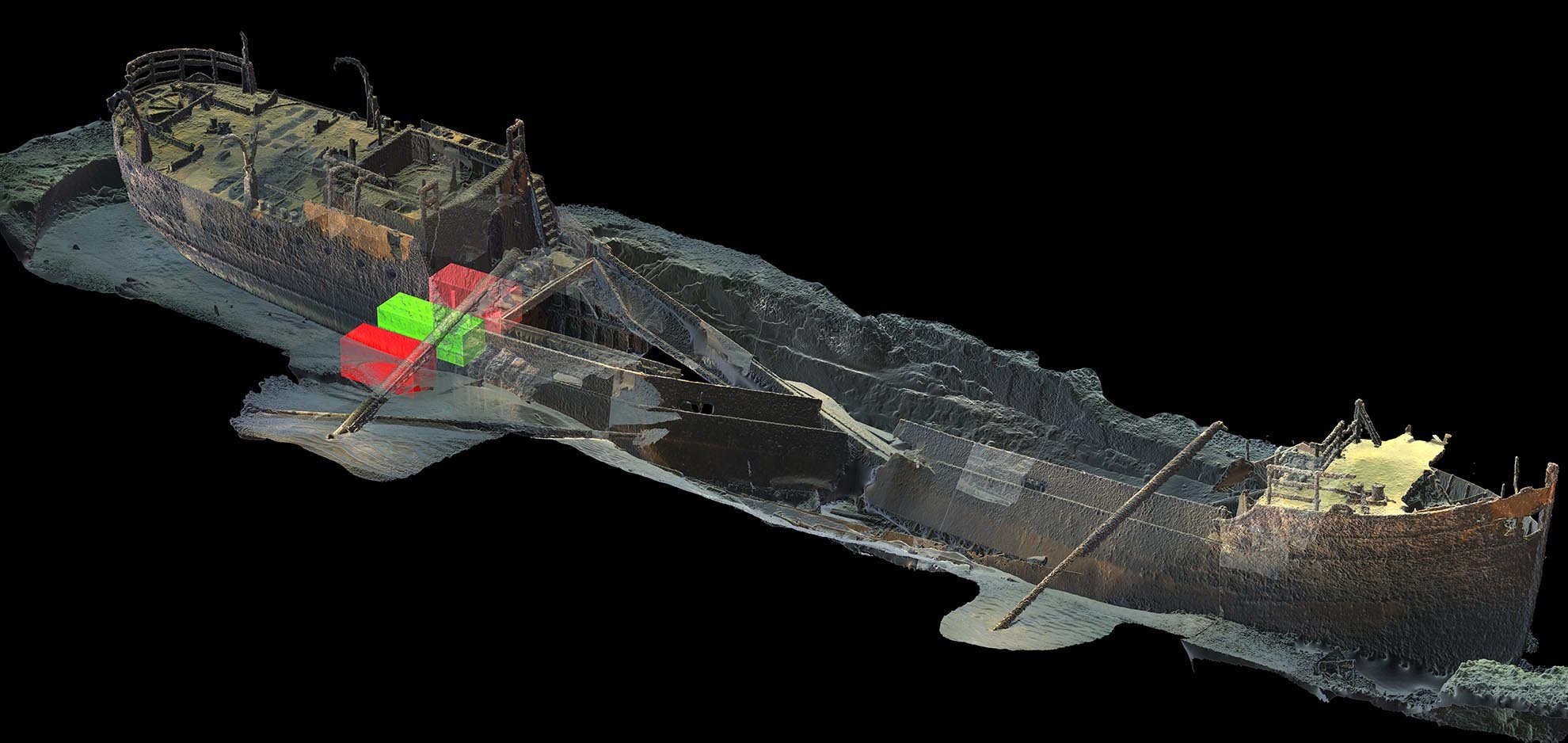
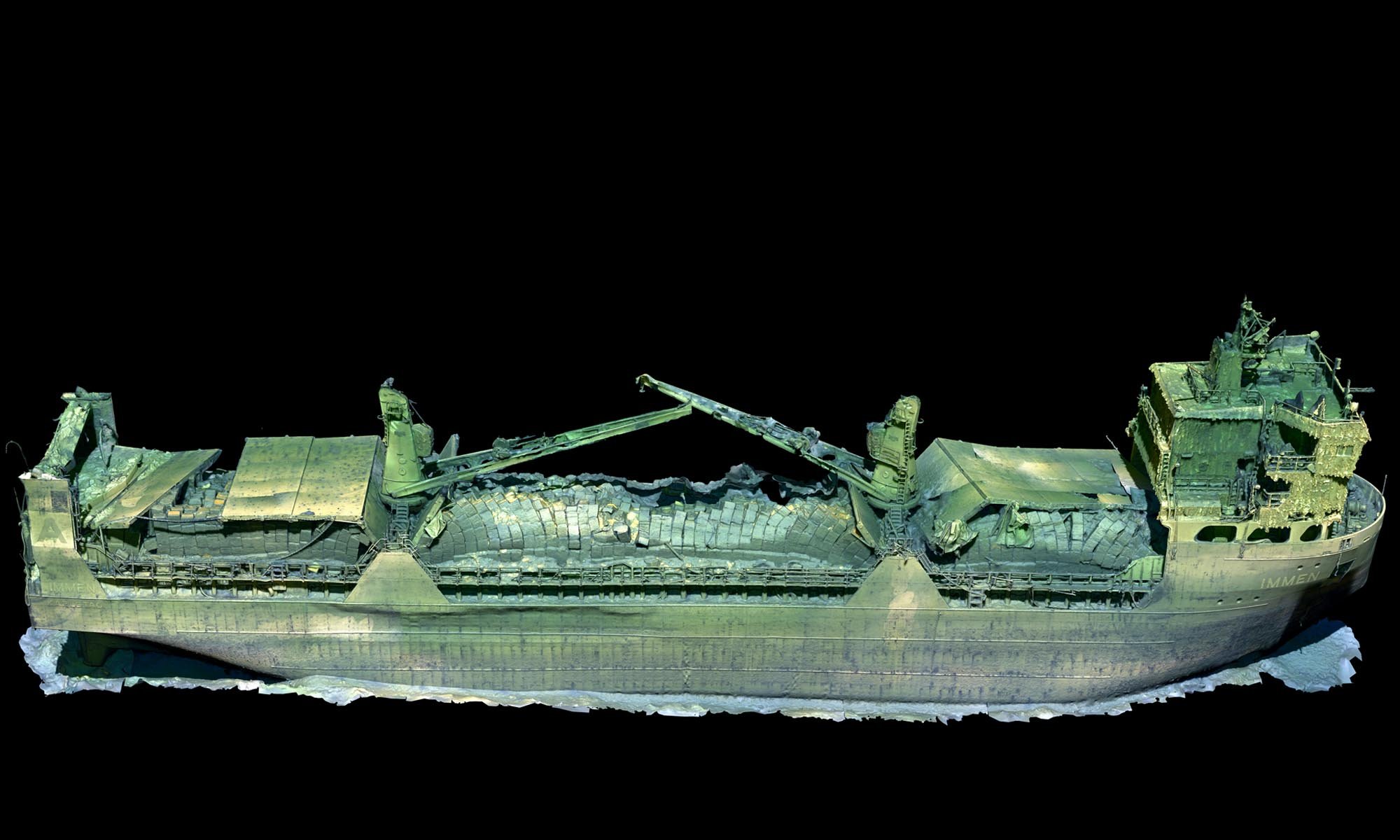
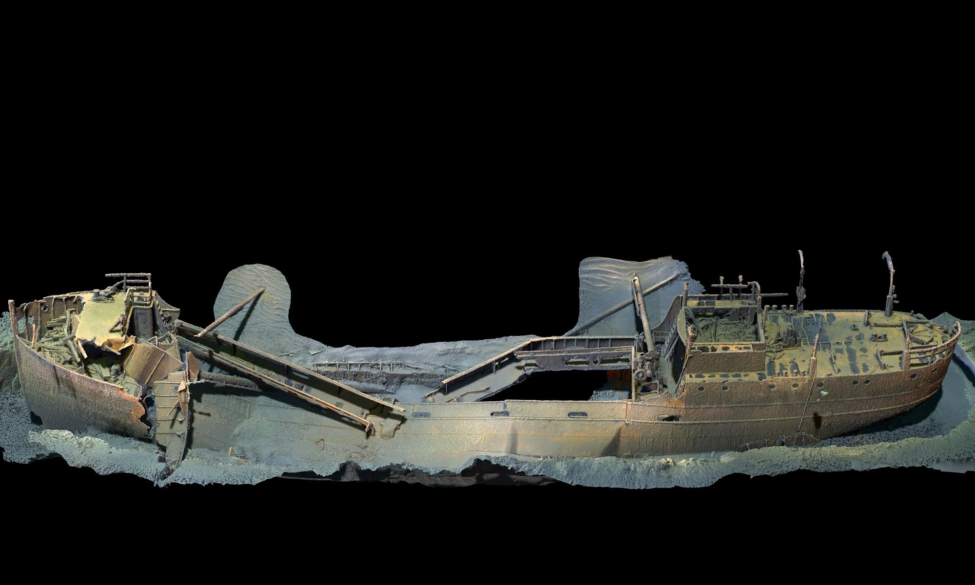
3D scanning of wrecks
Picture: Ocean Discovery
Picture: Ocean Discovery
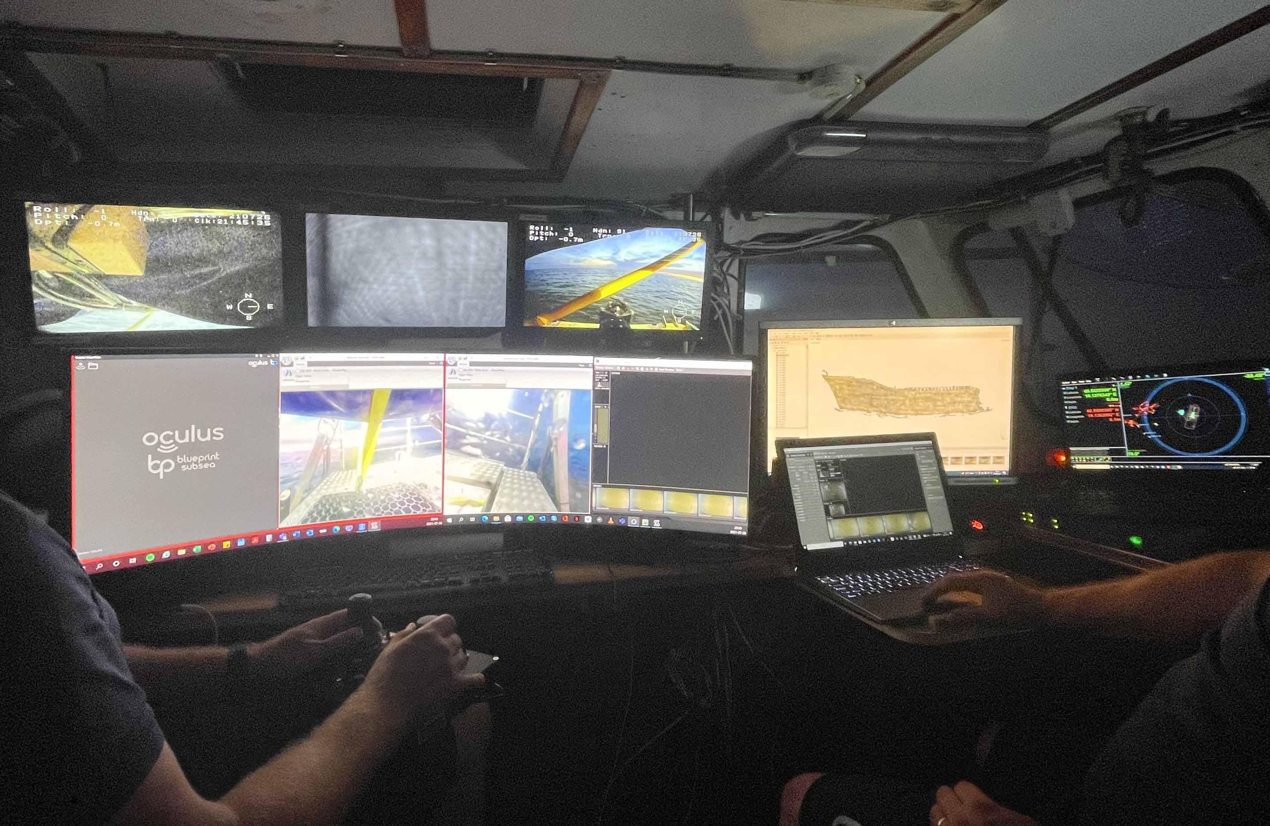
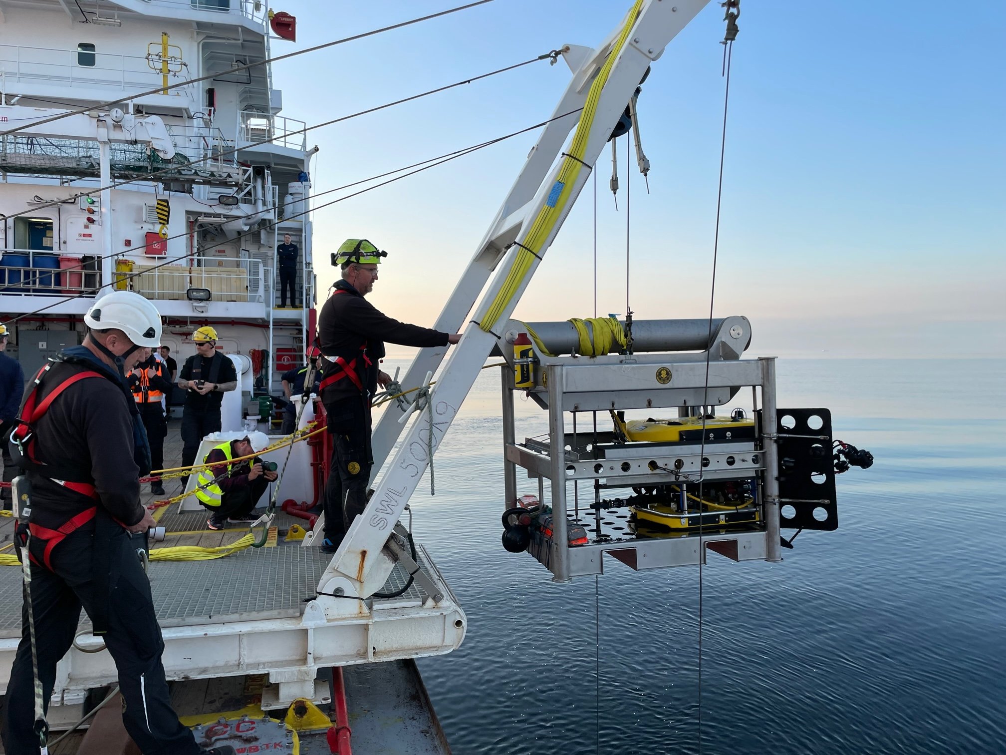
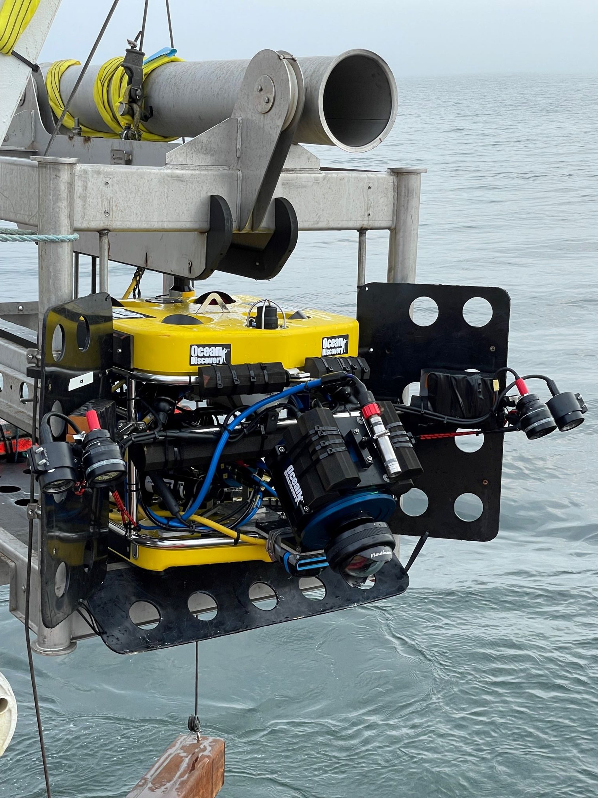
Photogrammetry uses Remotely Operated underwater Vehicles (ROVs) equipped with advanced still cameras and powerful flashes. The ROV operates down to a depth of 500m and together with survey vessels with dynamic positioning (DP) so the ROV can operate without anchoring.
Picture: Ocean Discovery
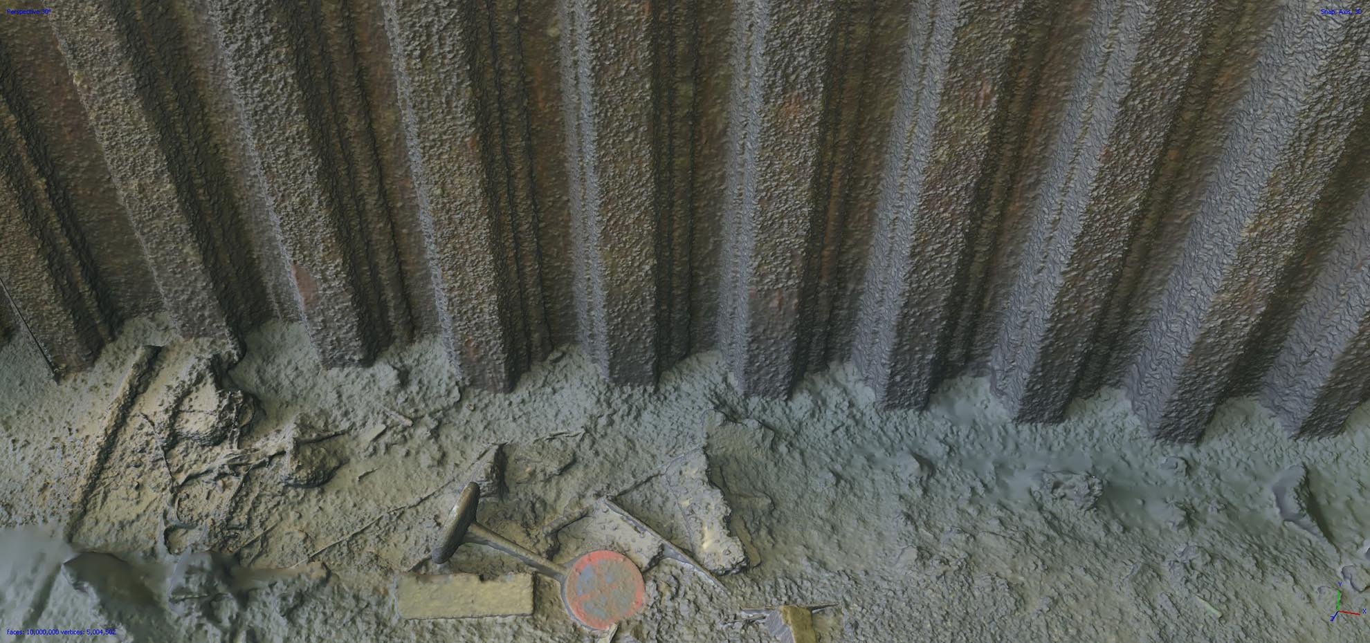
3D scanning involves collecting overlapping high-resolution still images that are processed by powerful computers using a method called photogrammetry. The result is a 3D model with a level of detail far superior to other documentation methods. The 3D model can be displayed from any angle or view, which offers an outstanding overview and basis for assessments.
3D scanning opens up new opportunities in, not least, accident investigations and marine archeology where the new technology can provide an overall picture of the entire wreck site as well as detailed studies of damage and technical details with the possibility of precise measurement within a margin of a few millimeters.
Picture: Ocean Discovery
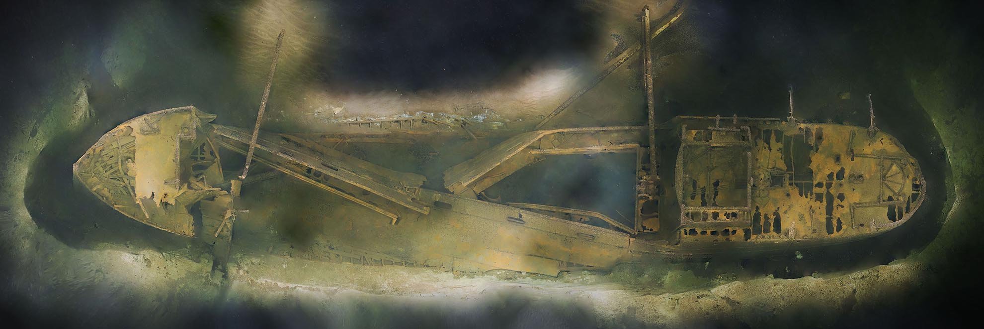
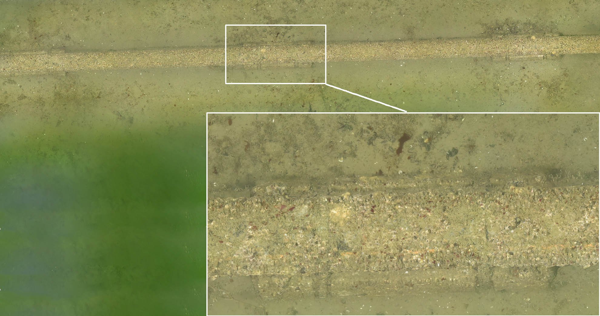
Orthographic pictures
Orthographic images are a composite image in bird's eye view of all the images that created the 3D model. Depending on the size of the project, it can be thousands of images that together form a single ultra-high-resolution image. The images can be generated in GeoTiff format so they can be opened in GIS programs where measurements and evaluations can be performed. With the help of underwater positioning equipment (USBL), the orthographic image can also be referenced geographically, so it is possible to determine the position of each point in the image.
Picture: Ocean Discovery
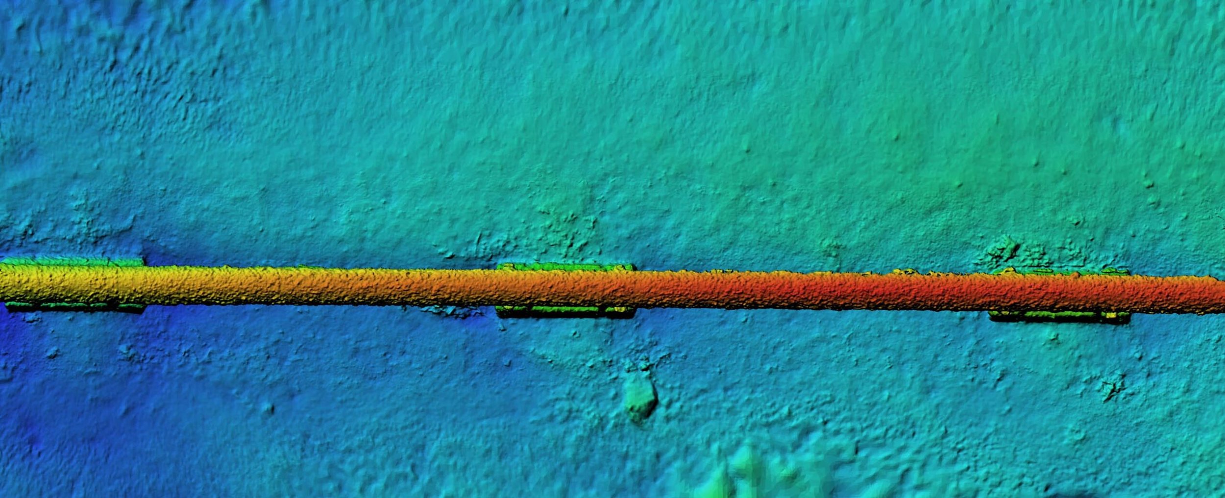
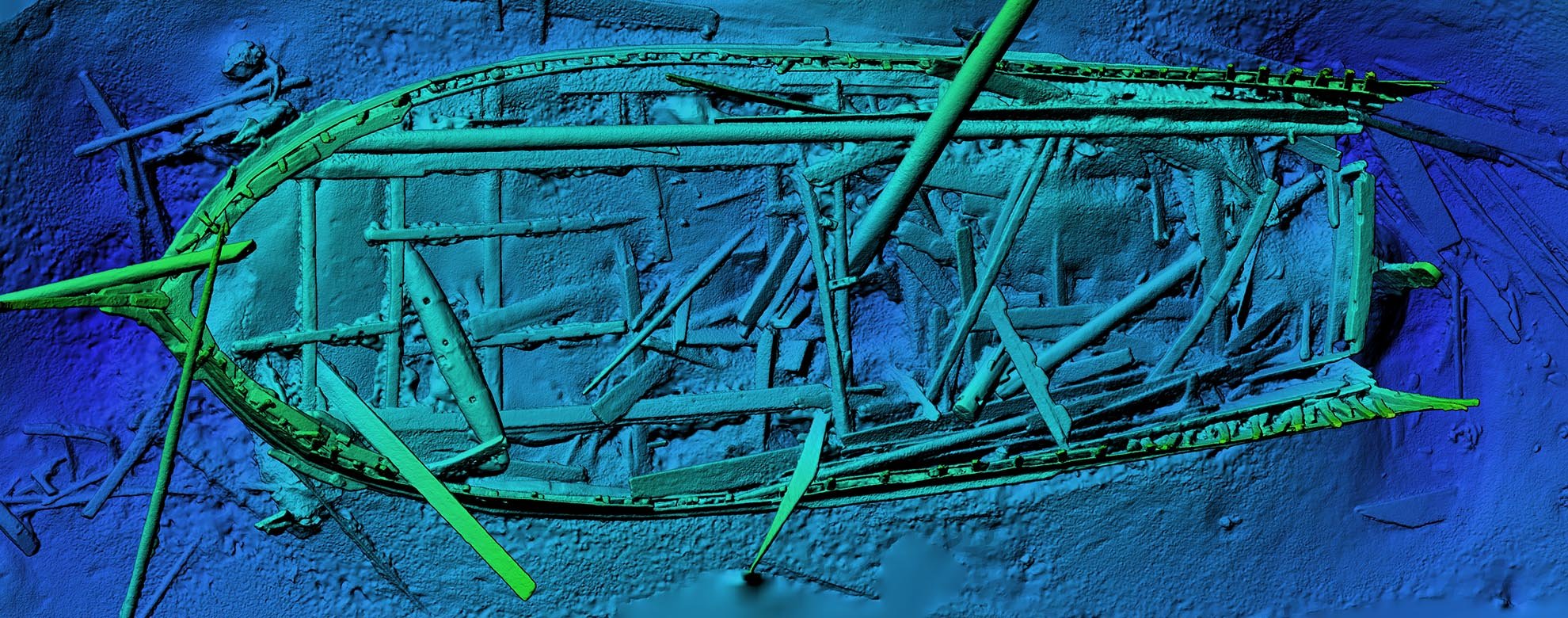
Detailed elevation maps - DEM
Detailed elevation maps (DEM) mean that each point in the image is assigned a color depending on water depth. The result is an image where every small difference in height is clearly visible and you get an immediate overview. The DEM image can be opened in commercially available GIS programs.
Picture: Ocean Discovery
Get in touch
I want to know more about 3D Scanning/Photogrammetry
3D Scanning/Photogrammetry makes a difference
Picture: Ocean Discovery